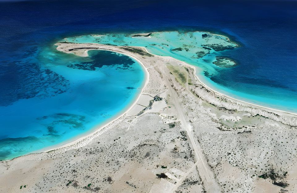
By sea
The usual way in is by sport boat or yacht; the open wooden peñeros are mostly used by fishers.
- to Cayo Herradura
- to Playa Caldera
- Permitted anchorage
- Approximate routes, not for navigation
Higuerote Miranda
| To | Distance | Launch ≈13 kn | Yacht ≈5 kn |
|---|---|---|---|
| Cayo Herradura | 50 nmi 93 km | 3½–4½ h | 9–11 h |
| Playa Caldera | 60 nmi 110 km | 4–5 h | 11–13 h |
Lechería · El Morro Puerto La Cruz
| To | Distance | Launch ≈13 kn | Yacht ≈5 kn |
|---|---|---|---|
| Playa Caldera | 52 nmi 96 km | 3½–4½ h | 9–12 h |
| Cayo Herradura | 68 nmi 126 km | 4½–5½ h | 12–15 h |
Porlamar Margarita Island
| To | Distance | Launch ≈13 kn | Yacht ≈5 kn |
|---|---|---|---|
| Playa Caldera | 82 nmi 153 km | 6–7 h | 15–18 h |
| Cayo Herradura | 95 nmi 175 km | 7–8 h | 17–21 h |
Distances are measured along the drawn route, which keeps clear of coasts and islands. Times reflect the choppy sea typical of this crossing, at average speeds of about 13 knots by fast launch and 5 knots under sail. In rough weather the crossing takes longer.
From Higuerote (Miranda)
This is the traditional departure point. Cayo Herradura is about 50 nautical miles away: in a fast launch, in the usual choppy sea, the crossing takes 3½–4½ hours, and 9–11 hours under sail; longer in rough weather. In a flat calm a powerful boat can do it in 2–3 hours, and camp operators advertise about 3 hours by sport boat, 4 by standard boat and 6 by passenger yacht. Most packages run Friday to Sunday (3 days, 2 nights).
Take care on departure
The Higuerote area has strong currents and considerable swell, and the crossing passes over the Cariaco Trench. Travel with operators who carry safety equipment and who reschedule if the sea is rough.
From Lechería and Puerto La Cruz (Anzoátegui)
Transfers also run from Puerto La Cruz. Yacht-charter companies in the Lechería and Puerto La Cruz area offer trips to La Tortuga.
From Margarita
Occasionally people sail from Margarita Island, leaving from Boca de Pozo on the Macanao peninsula.
Arriving on a foreign yacht
Check current rules and safety before you sail
Venezuelan formalities change often, and individual port captains may interpret them their own way. And since October 2025 Noonsite has warned that sailing inside or near Venezuelan territorial waters is "extremely high risk" because of US military strikes on suspected drug-trafficking vessels. Treat what follows as a guide only, and confirm it with the authorities, your marina or an agent before you go.
First, clear in at a port of entry
La Tortuga is not a port of entry. A foreign yacht must first clear into Venezuela at an official port. Noonsite lists as ports of entry Puerto La Cruz, Porlamar and Pampatar (Margarita), Cumaná, Carúpano, Carenero, La Guaira–Caraballeda and Los Testigos, and also covers Puerto Cabello. For La Tortuga the nearest are Puerto La Cruz, Carenero and Margarita.
According to Noonsite's advice as quoted by Onboard Online, clearing in follows this order: 1) customs (SENIAT), 2) immigration (SAIME), 3) port captain (INEA), with the ship's papers, a crew list with passport details and clearance from your last port. A cruising permit is then issued. There is no clearance at weekends. In Margarita, customs, immigration and the port captain share offices in Porlamar, according to a 2011 cruiser report on Noonsite.
Then, a zarpe for La Tortuga
To move between ports you need a zarpe (departure clearance) from the port captain. If you want to stop at the islands between Margarita and Bonaire, say so when you clear out and ask for the stops ("puntos intermedios") to be noted on the zarpe. Cruisers have reached the islands on a zarpe from Puerto La Cruz that authorised the visit. For Venezuelan pleasure craft, INEA issues zarpes online and through its App Zarpes.
At La Tortuga
- Days: under the resolution published in Gaceta Oficial No. 40,259 (2013), private and tourist boats may only arrive on Fridays, Saturdays and Sundays. A cruiser report on Noonsite from some years ago said the Coast Guard enforced this mainly with motor boats and was more relaxed with foreign sailing yachts. Don't rely on it.
- Anchoring: the same resolution sets the anchorages at Cayo Herradura and Playa Caldera, 50 m from shore, and requires you to take your rubbish back to the mainland.
- Authority: the resolution makes the Coast Guard Command, through its main station "TN. Fernando Fernández" at Guanta (Anzoátegui), responsible for enforcing the visitor limit. The Navy keeps small posts on the island. On arrival, keep your zarpe, ship's papers and passports to hand in case the Coast Guard visits.
La Tortuga is not a port of entry: arrive already cleared into Venezuela and with your zarpe in order, and confirm the latest requirements with the port captain (INEA) before sailing. Sailed here recently? Share your experience at [email protected].
By air
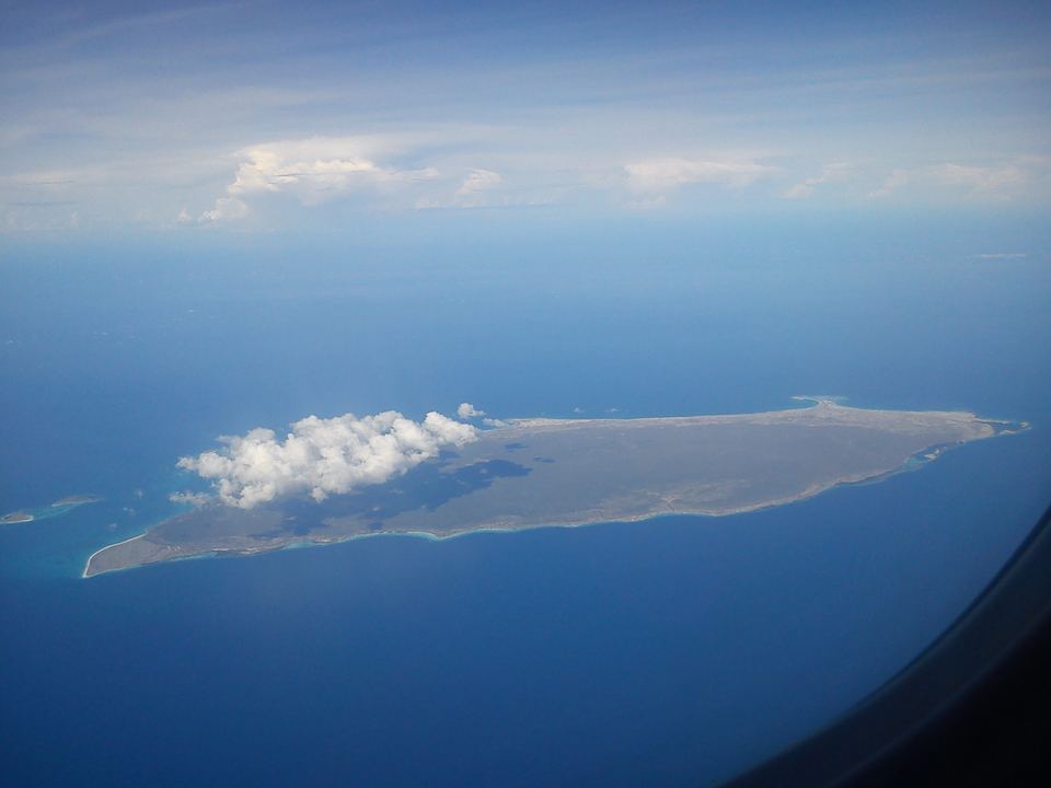
There is no airport, only a rudimentary airstrip. For years private light aircraft flew in from Higuerote, Charallave or La Carlota (Caracas), but these flights are now restricted by Venezuela's civil aviation authority (INAC). If you plan to fly, confirm the current situation with INAC and your operator.
Practical tips
- There are no paved roads; getting around is by boat.
- Outside the camps and the Playa Caldera complex there are no services. Bring water, sunscreen, a hat and insect repellent.
- Nights are often breezy and cool: pack a warm layer.
- Camps usually have a generator and a charging point; check what each package includes.
- Check the sea forecast before you go.
Travel advisories
Some governments publish travel advisories for Venezuela. Check your own government's advice before planning; for example the US State Department or the UK FCDO.